Preserving Madagascar’s biodiversity using satellite imagery

Madagascar may be famous for its lemurs and breathtaking scenery, but it is also one of the world's 36 biodiversity ‘hotspots’. These are characterised by an exceptional concentration of endemic species* but also by a very high risk of degradation. Evrard Wendenbaum, founder of the environmental association Naturevolution, explains the importance of biodiversity in Madagascar’s Makay massif, and how Airbus satellite images have helped the association to protect it.
It was during a 2007 expedition to the Makay massif, in Madagascar’s east,that Evrard Wendenbaum discovered the extent of the degradation in this apparently pristine area. He decided to create Naturevolution. “Our initial aim was to support scientific research and collect data to provide evidence of the threats facing the area,” Evrard explains. Despite several expeditions and the enthusiasm for this incomparably rich, diverse area, few protection measures have been launched. “When the world doesn't move, we end up moving ourselves.”
Diverse geology, exceptional biodiversity
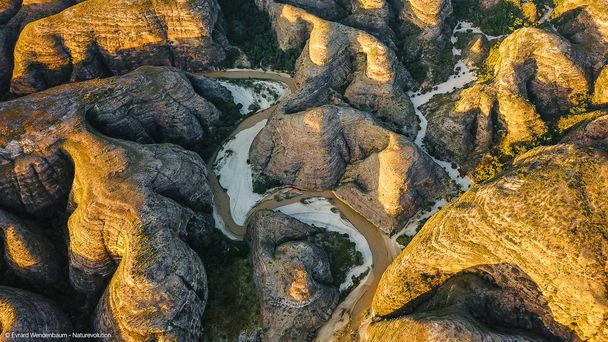
The Makay massif, a labyrinth of canyons and forests, is an area where unique flora and fauna have flourished for thousands of years.
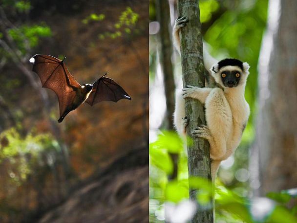
With 83% of its flora endemic and between 80 and 90% of its fauna, including 100% of lemurs and 99% of amphibians, the Massif is a veritable sanctuary of biodiversity. It has a particularly high rate of endemism*. This makes the region one of the most crucial areas on the planet to protect. Madagascar's vast surface area favours a remarkable wealth of species including 400 species of amphibians and 113 species of lemurs, further amplifying the biodiversity. These animals are extremely sensitive to the degradation of their habitat, because they are dependent on certain types of vegetation. This makes the need for a conservation programme all the more urgent. What's more, of the 1,754 species catalogued by Naturevolution in the Makay massif, 433 are on the International Union for Conservation of Nature (IUCN) red list, i.e. threatened with extinction. They include Verreaux's sifaka lemur.

This 4,000 km2 massif also has a very specific geology, with isolated massifs of sedimentary rock, such as the Tsingy de Bemaraha Park. These terrestrial reliefs are unique, and veritable natural refuges. Made of sandstone, they are riddled with caves, and act as a freshwater reservoir that feeds all local rivers. In an area of Madagascar with low rainfall, this is an important asset.
An endangered area
Certain cultural habits can have a dramatic impact on biodiversity. This is particularly the case in Madagascar, where fires are used both for agricultural purposes and for hunting.
Food insecurity is another threat. One of the main sources of food in the Makay is rice, which is grown near rivers and requires a lot of water. However, the reduction in rainfall on this part of the island, linked to climate change, has greatly reduced agricultural production, forcing inhabitants to move into the forest to meet their needs. “This phenomenon adds another layer to the risk of animal extinction,” Evrard explains. “Everything is interlinked, species interact with each other. All you have to do is remove one species of tree and that will extinguish an astronomical number of insects, primates and birds with it.”
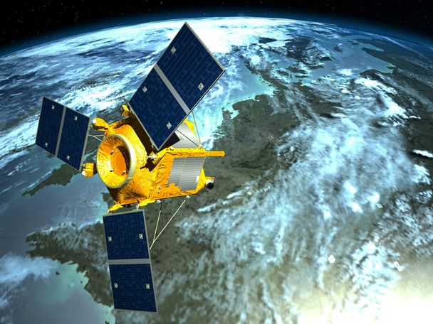
SPOT satellite images have helped the association to gain a better understanding of this labyrinthine territory by facilitating their scientific research. SPOT images cover very large areas in a single pass, while offering very fine resolution and access to a huge amount of detail about the vegetation cover. This is the ideal combination for studying thousands of hectares of forest in detail, and rapidly identifying areas of damage.

Satellite imagery, the key to penetrating the Makay fortress
“Without Airbus’ satellite imagery, we would never have been able to penetrate this territory,” Evrard says.
The Makay massif is renowned for being a labyrinth of canyons in which it is easy to get lost. Satellite imagery made it possible to identify rivers and lakes, as well as small forests, in which the team discovered previously unknown species such as the Pachypanchax fish.
“On the scientific side, we needed to identify the different species of animals and vegetation, classify them and also separate and quantify the types of forest cover: dry, wet or swamp,” Evrard continues. The teams of eco-guards identified each endangered species on the basis of plots defined on satellite image maps. “This scientific data has enabled us to gain a more detailed understanding of the species present, their distribution and their ecological preferences, so that we can monitor their evolution over time. In this way, the association can define the risks and priorities of conservation actions and measure their impact.”

From space to the ground: satellite mapping
There are no administrative maps of the Makay to identify villages, water systems or roads. “We wanted to set up a protected area, and the satellite images enabled us to delimit it geographically and create maps used for the area's development and management plan,” explains Evard. “Thanks to the imagery, we were able to record the population densities of lemurs and birds, as well as the number of inhabitants by identifying the number of huts in the villages.
The satellite images are also useful for raising awareness in local communities. ‘We realised that our maps, which were too stylised, were difficult for local communities to read. Photos are clearer, especially in mountainous terrain.”.
Satellite images have proved very useful for covering vast areas, identifying landscapes, producing maps and monitoring species, in order to protect biodiversity in these remote areas. “They are also good tools for providing evidence of damage and quantifying the impact of actions,” Evrard concludes.
Naturevolution
Together with its local teams, the association is involved in a number of conservation initiatives in the Makay massif, including support for education, access to water and lighting, and support for food sovereignty. Thanks to kitchen gardens and school rice paddies, for example, communities are learning new cultivation techniques and using varieties that are better adapted to water loss.
To find out more, visit the association's website.
*endemism: Presence of an animal or plant species in a limited area of distribution that is specific to that territory.


