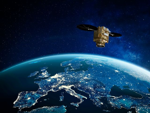
Artificial intelligence is the buzzword of the year, if not the decade. No longer limited to futuristic imaginations, it is actively changing society, and bringing with it great opportunities to better address tomorrow’s global challenges.
Artificial intelligence (AI) has brought fundamental changes to how data is processed and analysed. Its speed and efficiency means using it can bring improvements to every industry. At Airbus, AI is not a new phenomenon – it's already being used internally to improve production, manufacturing and operational processes. It is also used in the software of some of our products, improving operational performance and safety.
A key area where AI has played a huge role at Airbus is in Earth observation. Airbus provides a range of satellite imagery services that help customers respond more effectively to natural disasters, monitor environmental changes such as deforestation, and maximise farming yields and fertilisation. AI improves these services as it enables data to be processed at incredible speeds, while leveraging machine-learning to fill in gaps in information and predict results. This enables real-time monitoring that would be impossible to do manually. It also enhances precision, reducing the likelihood of error.
AI is able to automate things like pattern recognition and predictive analysis, allowing it to detect anomalies immediately and without human oversight. These anomalies can then immediately be flagged for customers, allowing them to respond swiftly to emergencies or irregular changes, improving their decision-making capabilities and resource allocation. The AI is also powerful enough to run many algorithms in tandem, permitting it to scan for any need to activate a range of different emergency protocols.This results in a faster, more focused response.
In practical terms, there are several primary ways that AI-powered services improve satellite imagery results for our customers. Take a look at just a few of the highlights below.
Enhancing satellite imagery for better wildfire management
Climate change has made some environments around the world warmer and drier, which has increased both the frequency and burn area of wildfires. When it comes to firefighting, the ability to quickly detect, assess and respond to wildfires in real time is paramount. Pléiades Neo, Airbus’ Earth observation satellite constellation, provides key support to those fighting fires on the ground. Its high-resolution imagery of wildfires greatly enhances situational awareness for firefighters, allowing them to track the evolution of fires, predict their spread and identify safe evacuation routes. Its data can also be combined with that of other satellites to have a larger view of a situation at lower resolution.
The Pléiades Neo imagery is provided in 30 centimetre resolution, meaning one pixel of an image represents a 30 x 30 centimetre square of the planet. The utility of this extremely high-resolution imagery is taken a step further by the AI-powered software that is able to identify tiny changes and flag them for review. This allows our customers to react to new threats as quickly as possible, without waiting for them to become large enough to be detected by the naked eye.
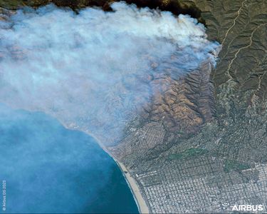
Pléiades Neo © Airbus DS 2025
Tracking deforestation from space
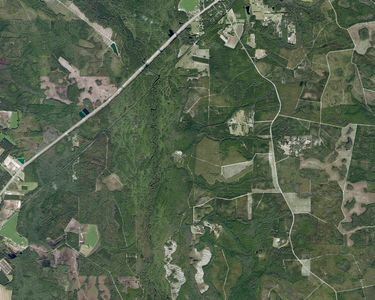
Pléiades Neo © Airbus DS 2023
Deforestation is a significant contributor to climate change, and the supply chains of certain commodities – including palm oil, coffee, cocoa, rubber, pulp and paper, timber and soy – are known to be at risk of supporting deforestation. Starling is a software programme founded by Airbus to help companies combat deforestation and meet their responsible sourcing requirements.
Starling analyses high-resolution imagery from ESA’s Sentinel-2, NASA’s Landsat and Airbus’ Pléiades Neo and SPOT satellite constellations, and uses AI-powered algorithms to detect suspicious changes in forest cover and identify deforestation. This is especially important as some, though not all, deforestation takes place in very remote areas far from human sight. Being able to identify damage in real time allows companies to implement mitigation measures as quickly as possible, supporting biodiversity and responsible land use.
Increasing harvest quality and yields

Farmstar is another Airbus product that uses AI-powered algorithms to improve farming productivity and yields for wheat, barley and rapeseed crops. Vegetation reflects sunlight differently depending on its development, which can be discerned in satellite imagery. This information is then processed by algorithms and combined with meteorological data to provide advice about soil conditions, crop health and environmental factors. These recommendations can then be used to help optimise farming practices, leading to increased yields and crop quality.
Farmstar supports precision fertilisation by tracking nitrogen levels. Its algorithm can then recommend where to add more fertiliser and where to withhold it. This is called automatic variable rate application, and it saves money for the farmer and reduces the amount of fertiliser used, reducing its environmental impact.
Farmstar can also support the growth of sustainable aviation fuels. It can optimise the yield of the crops used for SAF production, and find the right balance between crops to feed populations, crops to produce SAF and intermediate crops to absorb carbon emissions.
Discover more Innovation news
Continue Reading
Web Story Innovation
Testing the open fan’s promise
The open fan combines the fuel economy of a turboprop with the performance of a turbofan. It has the potential to significantly boost the fuel efficiency of a next generation aircraft.
Web Story Innovation
Digital Twins: Accelerating aerospace innovation from design to operations
Web Story Innovation
How to mitigate contrails and other non-CO₂ emissions
Web Story Innovation
Improving the world we live in with AI-powered products
Web Story Defence
Airbus and European innovation - Imagining a future combat aircraft cockpit
