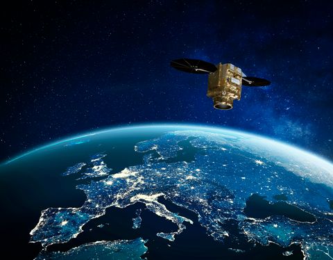
Biomass, a satellite to look inside the world’s forests like never before
Most of us learned in school that trees absorb carbon dioxide (CO2) during photosynthesis, store carbon in their cells, and release oxygen into the atmosphere. This process plays a significant role in the carbon cycle and helps regulate the Earth’s climate. However large-scale data on the amount of carbon stored in the world’s forests and how they are changing over time is not readily available.
This is where ESA's Earth Explorer Biomass satellite, built by Airbus, comes in. Set to launch in the coming days, this mission aims to fill the gap in our carbon cycle knowledge by providing accurate and detailed data on forest biomass* and forest height, supporting our understanding of climate change.
*the woody matter of trees (trunk, branch, stem)
Forests: the carbon sinks of our planet
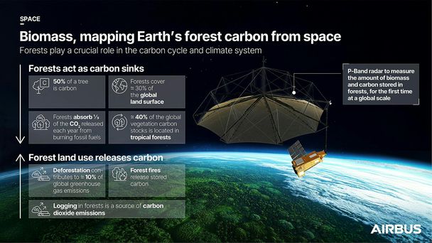
Covering nearly 30% of the Earth's land area, forests are one of our planet’s most valuable resources. They help regulate ecosystems, protect biodiversity and are a critical component of the global carbon cycle. Growing forests absorb roughly one-third of the CO2 released each year from the burning of fossil fuels, acting as natural carbon sinks and slowing global warming.
Scientists estimate that about 50% of a tree's dry weight is carbon. Forest carbon is currently assessed using on-ground inventory data and equations. Unfortunately, field measurements can be difficult to obtain in some parts of the world due to remoteness, lack of capacity, data scarcity, or geopolitical issues, making the approach difficult at large scales.
“To address this data challenge, the primary focus of carbon mapping with Biomass is on tropical forests, where data is scarce. These regions are of particular interest because they store the majority of the world's forest carbon and are where most changes in forest biomass take place,” explains Björn Rommen, Biomass Mission Scientist at ESA.
The most significant changes in carbon stocks occurring in the Tropics are mainly driven by land use changes such as deforestation, logging and burning. The three countries with the largest tropical forests - Brazil, Indonesia, and the Democratic Republic of the Congo - together generate 55% of the net global CO2 emissions caused by changes in land use (over 2014-2023). These carbon fluctuations can have a substantial impact on the global carbon cycle and contribute to climate change by generating carbon dioxide, the primary greenhouse gas.
"The role of forests in the global carbon cycle is not fully understood," explains Rommen. “We are lacking data about carbon stocks and fluxes, forest dynamics (growth, regeneration, mortality) and how they react to climate change. By improving our understanding of these processes, we can better manage forests and quantify their role in a changing climate.”
Scanning Earth’s forests. A breakthrough with P-band radar
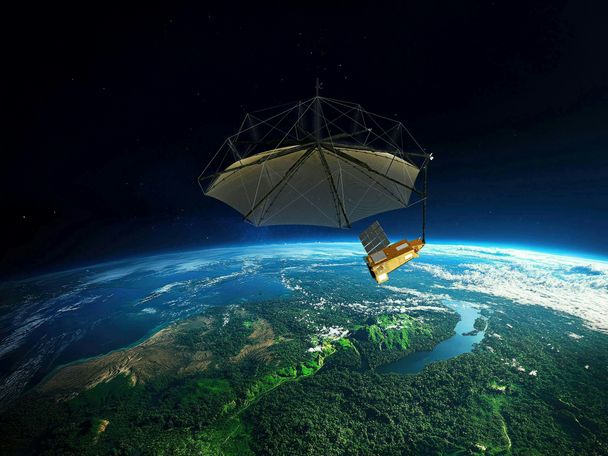
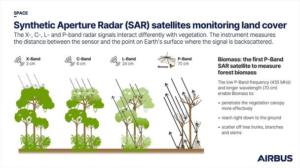
The Biomass satellite will accurately map aboveground biomass (AGB) over large areas using a synthetic aperture radar (SAR). What's unique about this SAR is that it operates in the P-band wavelength, a first for use in space. The 12-metre-wide wire mesh reflector is provided by L3Harris. Unlike commonly used X-, C-, and L-bands, P-band's 70 cm wavelength offers distinct advantages. Its longer wavelength enhances the SAR signal's ability to penetrate the vegetation canopy down to the ground. An electromagnetic wave only interacts with objects of roughly the same size as its wavelength. So, with the P-Band, SAR can “see” all objects of 70 cm and more but not the smallest ones, such as leaves. Biomass waves will therefore pass “through” the foliage, interacting with the larger woody components, including trunk and branches, thus enabling accurate measurements of tree height, structure and density, even in dense forest.
Moreover, the radar sensor operates day and night and also penetrates cloud cover. The collected data and ensuing processing allow direct imaging of the forest interior at unprecedented scale, making this instrument an ideal tool for this groundbreaking mission.
Measuring carbon from space, from a single tree to entire forests
“The Biomass satellite mission will measure forest biomass and height during its initial phase, using the SAR tomography technique**. By capturing multiple images of the same area in a short time span, a 3D map can be created to identify different forest types and vertical structures,” explains Rommen.
During the second phase of the mission, repeated measurements over multiple years will enable the scientific community to identify forest loss and regrowth, as well as evaluate forest biomass evolution.
The data collected from space will be compared with on-the-ground measurements, such as those provided by the GEO-TREES initiative, to calibrate and validate Biomass estimates. The GEO-TREES forest inventories involve mapping and geolocating tree-by-tree measurements, including diameter and height, and identifying species with the help of botanists. The plan is to include more than 100 sampled tropical forest sites, which are available for the scientific community.
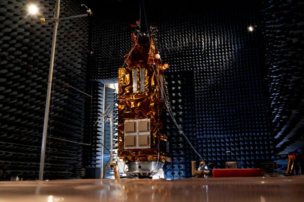
Biomass during Electromagnetic Compatibility (EMC) tests at Airbus facilities
Filling the gap in climate models for effective climate change solutions
Biomass enables scientists to monitor deforestation, forest degradation, and reforestation, tracking carbon fluxes on a global scale over time. This data enhances our understanding of the global carbon cycle, improving climate model predictions for effective mitigation and adaptation strategies.
“Carbon cycle and forest modellers can characterise the present state of the tropical forests and model their evolution over time, transforming radar imagery into maps of ‘tons of wood’ per hectare. This data is valuable for governments committed to reducing carbon emissions and for policy-related activities such as those under UN REDD+ or UNFCCC,” explains Rommen.
Forests offer a significant opportunity to sequester additional carbon through reforestation projects and conservation efforts. The satellite will also enable the quantification of biomass loss from illegal logging and deforestation, assisting authorities in combating this challenge.
In addition to its primary mission, the satellite’s data can be used to measure ice velocities and subsurface ice structure in Antarctica, map subsurface geology in deserts, and determine topography under dense vegetation.
Biomass is a groundbreaking five-year mission, from the first use of space-based SAR in P-Band revealing forest biomass and height at unprecedented scale, to the diverse use of its data by those who protect and restore our forests, these vital carbon reserves that help regulate our climate.
**tomography: technique that uses waves (such as radar or X-rays) to reconstruct a 3D representation of an object by combining multiple 2D cross-sectional images. With Biomass, the radar signals will map three-dimensional structure of forests, including biomass and height.
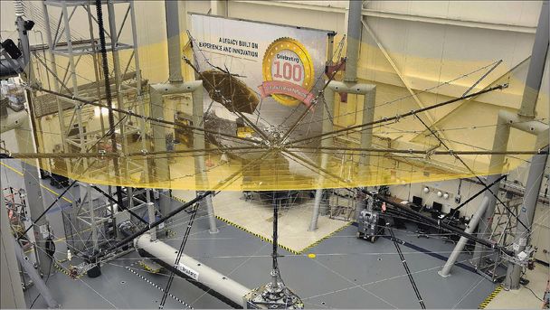
Biomass’ 12-metre wire-mesh reflector during its deployment procedure test.
© L3Harris

