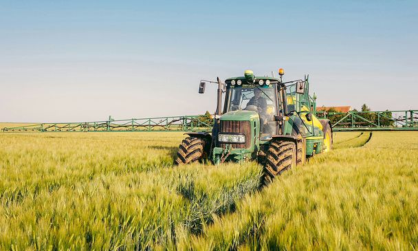
FARMSTAR: from satellites to farms

Satellite imaging and agronomic expertise
Agriculture requires an increasing role of innovative technology such as geospatial-driven information. Services like FARMSTAR, developed by Airbus Defence and Space, help thousands of farmers achieve a more effective and sustainable production of crops.
Precision agriculture Enhancing production and profitability from space
“Farming looks mighty easy when your plough is a pencil and you’re a thousand miles from the cornfield,” said Dwight D. Eisenhower, then president of the USA, during one of his celebrated speeches in 1956.
52-year-old farmer Stéphane Guillon thinks along the same lines. Until a little over a decade ago, he could only survey his fields of rapeseed, wheat and barley from ground level. Since then, he has also contemplated them from an altitude of 800 kilometres. Just as Eisenhower said, it’s much easier that way.
Guillon, who owns 340 hectares of land in the French municipalities of Lugny-Champagne and Charantonnay, was one of the first farmers to use FARMSTAR. The programme allows farming professionals know exactly what their crops need and achieve savings in the amounts of fertiliser and pesticides used on their crops.
Real decision-making aid for farmers
“The advantage is that I use less fertiliser and less pesticide, which also means I spend less money,” explains Guillon. His farming cooperative Axereal – the largest in France – sends him maps via the internet with up-to-date data regarding his crops. This information is used to determine the exact dosage of products his crops need.
Stéphane Caglioni, an agricultural technician at Axereal, confirms the level of satisfaction among users: “35 of the 55 farmers I work with at the cooperative already use FARMSTAR – and this number is increasing every year. They feel they’re being more environmentally responsible, as well as saving money.”
Side by side for sustainability
The United Nations warned that nitrous oxide (N2O) emissions, partly deriving from the widespread use of nitrogen fertilisers in farming, could double by 2050. N2O is 200 times more potent than CO2 as a greenhouse gas, so its impact on climate change is of concern. The United Nations has called on farmers to minimise “the loss of nitrogen to the environment that occurs during crop cultivation.”
That is exactly what farmers like Guillon are trying to do. And because the FARMSTAR service lets farmers avoid unnecessary tractor rides around their land, it reduces their diesel consumption – and the resulting greenhouse gas emissions.
Gleaning data for a more eco-efficient future
Airbus Defence and Space is also involved in a research initiative with leading insurance actors to develop products to cover weather perils based on meadow yield measurements thanks to remote sensing. The main objective is to identify and quantify production loss in order to compute accurate compensation for crop shortfalls and associated financial loss.
Fifteen years of research have resulted in a service that works in a very simple manner. Various Airbus Defence and Space satellites – such as SPOT 6 and 7– constantly record the solar energy reflected by the different crops.
The variations detected make it possible to calculate the amount of chlorophyll in the plants, which is correlated with their nitrogen levels. This in turn allows farmers estimate how much pest control and fertiliser their crops need.
The data is also entered in agronomic models that take into account weather conditions and the characteristics of each plot, enabling preparation of precise instructions tailored to the needs of each farmer.
Broadening horizons for a winning combination
In 2015, Airbus Defence and Space, Arvalis – Institut du Végétal and Delta Drone went one step further by exploring the potential offered by data acquired from sensors carried on-board UAVs.
A number of experiments were carried out over plots of farming land and demonstrated that observation capacity with a variety of sensors can dovetail perfectly with the already existing satellite data used by FARMSTAR.
The addition of UAV data could lead to the optimisation of crop diagnostics, delivering top-quality benefits for farmers, while maintaining services devoted to precision agriculture and sustainable crop management.
The data acquired determines exact dosage of products needed for optimised crop diagnostics